Showing posts with label Champlian Canal. Show all posts

Wednesday, January 29, 2014

Photo Essay: Part 3- On Our Way to the Lake

As time slides along its inexorable path, we humans do not realize the history we may witness, and which we fail to record. The events of today are the history of tomorrow but we do not recognize it until much later.
Thus begins the preface to a very good book called The Champlain Canal: Mules to Tugboats by Captain Fred G. Godfrey. I bought this book at the history fair last fall. The statement is very true from my point of view. I hope this blog, keeping my diary, & introducing you & my daughter to local history are ways of documenting that history that night be lost

 The finale of our Champlain Barge Canal excursion happened in late October. Luckily the weather cooperated on all those Mondays.

Sediment dredged from the Hudson River is placed in these vessels^

The image above is slightly north of Lock 7 in Fort Edward, NY. This is where the Champlain Barge Canal leaves the Hudson River entirely behind on its path to Lake Champlain.

Historic marker at the aqueduct in Fort Edward, NY


The aqueduct in Fort Edward, just north of the Old Fort House, on the opposite side of US Route 4 is really beautiful, even if dilapidated. Further north there is an apartment building that used to house mules for changing out.

Part of the old aqueduct & junction locks in Fort Edward, NY


Panoramic view of lock 8 on the Champlain Barge Canal in Fort Edward*

Fiona took these shots with a panoramic feature on her iPod. She wanted to use them in her photo essay, but we couldn't get a decent print copy.


Panoramic view of Lock 9 on the Champlain Barge Canal in Smith's Basin*


Canal park- Old locks in Fort Ann, NY


The doors of the lock at Lock 10 in Comstock*

Lock 10 is located in Comstock, NY. In the photograph below you can see the red barn and other buildings of the Washington Correctional Facility compound. My father, Iliff W. Dolton, Jr. worked at this NY State medium-security prison for over 20 years.


Washington Correctional Facility as seen from Lock 10*

Lock 12 of the Champlain Barge Canal is in Whitehall, NY & is at the base of Lake Champlain. During the summer months it can be quite busy, but it was pretty quiet with the spent fall foliage. (Did you notice? There is no Lock 11. It was deemed unnecessary & never built.)


NY State & NY Canal Corporation flags fly over Lock 12


Sign for safety at Champlain Barge Canal Lock 12 in Whitehall, NY

By the time we hit the last lock in Whitehall, NY we were a bit silly. Well, I guess we tend to be a bit silly most of the time, especially when we are traveling, & singing in the car.

Fiona caught me acting goofy at Lock 12*


Fiona took a selfie at Lock 12*

Thank you for coming on Fiona & I on our adventure. I hope you plan one soon!


* These photographs were taken by Fiona A. Dolton-Coons on her iPod 5 in October 2013. None of these were used in her final photo essay for JAC.

^This photograph was taken Fiona A. Dolton-Coons on her iPod 5 in October 2013. It was used in her final photo essay for JAC.

*** UPDATE: On March 1, 2014, Fiona was awarded First Place in the Junior American Citizens Photo Essay "Honoring Our Heritage" by the NY State DAR. ***

Wednesday, January 22, 2014

Photo Essay: Part Two- Reminiscing Lock 6

Fiona & I continued our little Monday adventures around the Champlain Canal, up & down US Route 4. We watched the dredging near our house, just below Lock 6. The sound of the machines groaning through the valley, especially at night. I told her a bit about my life growing up along the Hudson.


Looking south toward Lock 6 from one of the bridges
 I'm not sure if it was this one or the one further north, but during the summer local kids, mostly boys, would jump off the bridge into the canal below. This part of the Hudson is not safe to swim in, especially with the dredging. Also, this part of the canal is lined with large pieces of cut stone. No swimming, or diving is allowed in the canal.

Lock 6 filling up
When my younger sister, Heather, & I were little, our mom & aunt used to bicycle us over to the canal from our house about 1/2 a mile away. One day a barge was going through the lock & we got to see the whole thing. The barge pull in, the water drain out with the barge slowly going down, the doors open, & the barge spill out into the Hudson headed south. One of the crew members threw up apples to us.

Looking north from Lock 6 in Fort Miller, NY

Full lock waiting for the down river arrival of a boat

Safety warnings so people don't fall in the canal

Cleengineering boat going through Champlain Canal Lock 6

Lock 6 has emptied and doors are opening to let out the southbound boat

Looking south from Lock 6- The Point is on the right
 In the image above, just around the corner from where the concrete ends in the upper right, there is a shale ledge called The Point. People used to go out there at night & party. But in the summers of 1985 & 1986, when we were really into INXS, Breathe, & Bryan Adams (sometimes we brought our cassette players), my little sister & I, & sometimes our friends, would go out there & wade into the Hudson. We soon realized that barefoot was a bad idea, so we wore our jelly shoes. Again, not a great idea because of the water pollution, but there is also a nasty current nearby.


Southbound boat is leaving Lock 6


The above is video my daughter, Fiona, shot while working on her photo essay. It shows Lock 6 closing its doors.


Dredging is underway south of Lock 6

Crocker's Reef Guard gate north of Lock 6
 When I was finally able to ride my bike well enough, I was allowed to ride along US Route 4 as far as what we called the "drop gate." It is actually called a guard gate, that helps protect the canal from flooding & snow melt in the spring.

Looking north from the Guard Gate toward Fort Edward


Wednesday, January 15, 2014

Photo Essay: Part One- Taking a different perspective

Every year the Daughters of the American Revolution offer educational programs & contests. This year I insisted that my daughter, Fiona (12), participate. She groaned, but I told her she could take pictures with her ipod & submit a photo essay for the contest. This got her attention. There is little she likes more (maybe One Direction, Little Mix, & 5 Seconds of Summer) than taking pics with her ipod.

Over the course of 5 separate Mondays she & I drove the length of the Champlain Canal taking photographs of the locks for the Junior American Citizens art contest. Fiona had to take her own photographs, which she did. I took my own & will share some of them here. I am really glad I insisted she do this because we had a lot of fun together, riding in the car, signing One Direction songs, getting "lost" in our search for Lock 1 at Waterford, exploring local history, & just being together.

Fiona at Lock 1- Champlain Canal, Waterford, NY

Lock 2- Champlain Canal between Waterford and Mechanicville

Lock 3- Champlain Canal, Mechanicville, NY

Fiona is king of the world- Lock 4- Champlain Canal, Stillwater, NY

Fiona snapping a pic- Lock 5- Champlain Canal, Schuylerville, NY

Fiona posing- Lock 12- Old Champlain Canal, Greenwich, NY

Trees growing through the masonry at Old Champlain Canal Lock 12

Old Champlain Canal- Lock 12

Historic marker at Lock 6- Champlain Canal, Fort Miller, NY

Fiona watching the doors open for a boat- Lock 6- Champlain Canal, Fort Miller, NY

Fiona & me basking in the September sun at Lock 6- 2013

Surprise! Great rest area along the canal north of Lock 6


All images by Tisha Dolton, Historian September-October 2013

Friday, June 21, 2013

The state of New York State historic markers in Greenwich

You've seen the blue & yellow roadside markers around the area. Greenwich even has a few brown & white ones. But we don't have very many.

The state started the historic marker program in 1926 to commemorate the sesquicentennial of the Declaration of Independence. The program continued, with state funding, through 1939. This explains why so many of the markers relate to the American Revolution, like the 2 below.

Located on Dix Bridge Rd in Clarks Mills


There are other historical markers around the town, but they were not put up by the state. State funding was removed from the program, but it was not abandoned. The state just decided that the municipalities should foot the bill for these expensive roadside sentinels. 

At the corner of Woodlawn Ave & Fisher St near the school

The Washington County Historical Society put up some markers, like the 2 below.

Near Dix Bridge at Hudson's Crossing in Clarks Mills
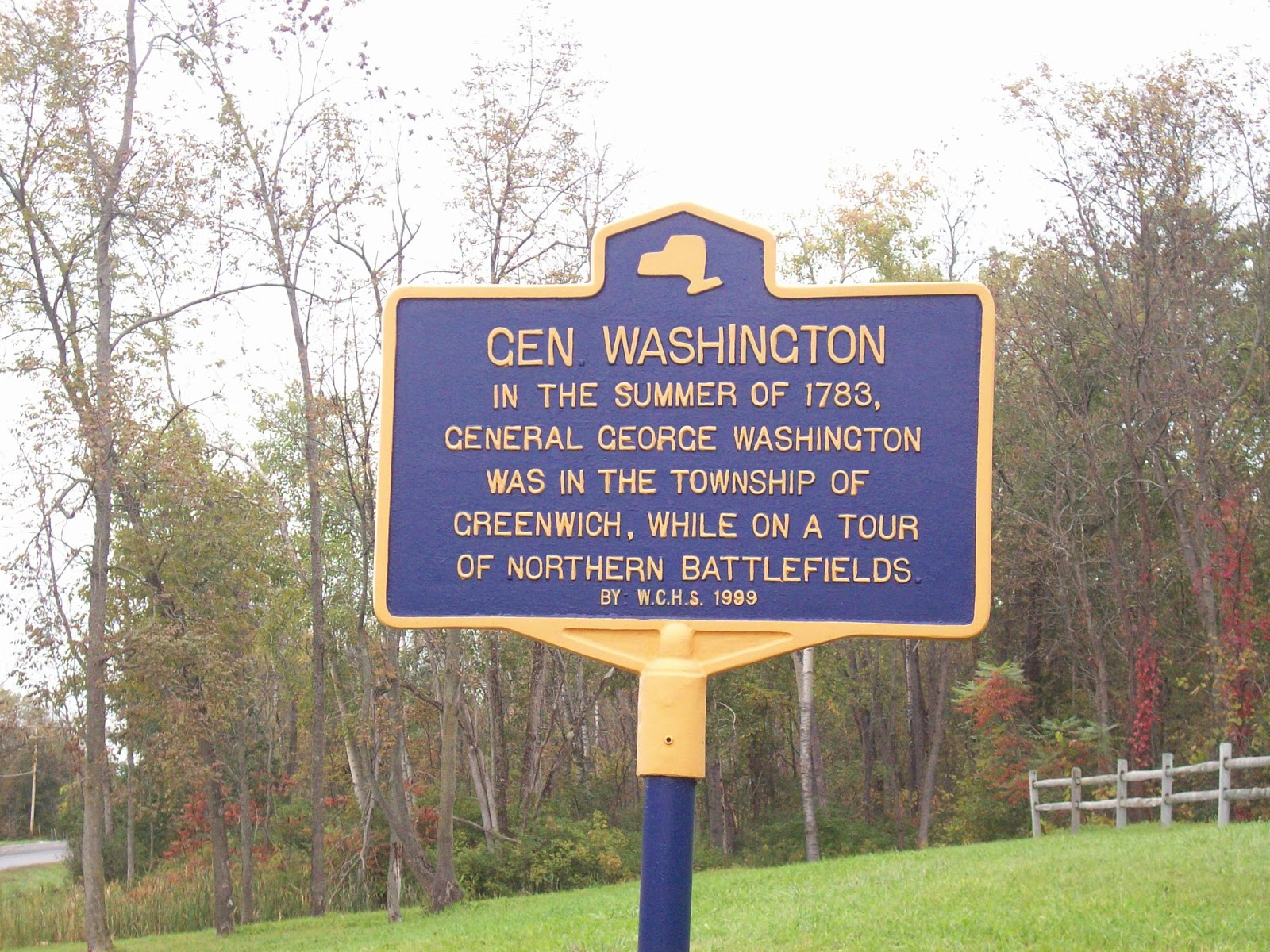
George Washington marker on US Rte 4 just before County Rte 77

Then we have some other markers. Like the plaque in Battneville put up by the Ondawa-Cambridge chapter of the Daughters of the American Revolution (DAR). It is inserted into a stone wall & is nearly impossible to read from the road. The sign is easier to see, but it is still not a historic marker. Susan B. Anthony & her family need a proper marker at their former home.

"EARLY HOME OF A GREAT WOMAN" the plaque reads

Sign outside the house on Route 29 in the hamlet of Battenville

& what about those brown & white markers? Aside from being ugly, they are harder to read than the blue & yellow ones. Who put these up, & when?

Not a very descriptive marker- along US Rte 4 near the Washington marker

Located at the intersection of County Rte 77 & Lick Springs Rd

The long & short of it is that we could erect some more historic markers in the town without shelling out our hard earned cash. The William G. Pomeroy Foundation has an historic roadside marker grant program. Starting on August 1, 2013 the grant application will be available for our region (APHNYS Region 5). If we choose a site or 2, & provide all of the necessary paperwork, we could receive the funding.

Any ideas? I was thinking the Anthony home in Battenville, the Main St. former site of the Free Church, founded in 1937 by Hiram Corliss, or the site of Union Village Academy.


Friday, April 5, 2013

Preparing for the big move...

It appears spring has finally sprung, as it always does, here in Greenwich. Just this morning traffic was backed up from the Mowry/Corliss/Main intersection to Cottage Street behind the street sweeper. Kids & adults alike were walking to the Greenwich Free Library without winter coats.

My new office is coming along nicely, but my packing is not. Every time I decide to look through something with the intention of putting it into a box, I come across really cool stuff. Stuff that must be perused & read right now!

Today, was just such a day. I opened the Historic Resources Survey boxes to see if there was anything on Riddle Road to aid in an e-mail inquiry (just a nondescript record on The Owl Pen) & realized that there was a wealth of information in those boxes. Plus, I need to go through & put the records in folders & label them. That will be my project next week! Oh, the survey was done in preparation for Greenwich's nomination for Historic District designation from the National Register of Historic Places & the National Park Service. Check it out here.

I found some information regarding the Lowber Lime Kilns in Bald Mountain & Old Lock 12 of the Champlain Canal. If any of you have been on the Facebook page you have seen the photo I posted, but there were a few others.So I ran them trough my new app "Photo Grid" & voile!

1981 images of the Lime Kilns with a 21st century shot of the marker

Mash-up of 1981 images and my 2009 photos

I also found some interesting historical "papers" included in the survey that I will be reading & sharing with you. An obituary on Ann Caroline Holmes (nee Mowry) really caught my attention. More research is needed there I think!

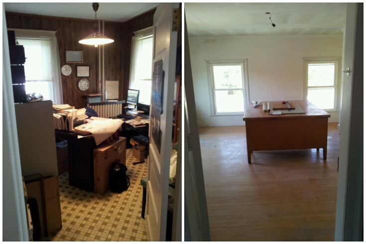
I'll leave you with images of my new/ old offices. I haven't been this excited since I got upgraded from Windows 3.1 to Windows 98! (Now I have Vista.)

work in progress- new Historian's Office upstairs

current vs. new- so much bigger


Thursday, October 25, 2012

Glass Negative Victory! (maybe)

Mom & I went to an event at the Greenwich Free Library last night.

K. Walter Grom, former Siena College Professor of German Language, History & Culture, presented a slide show on "General Philip Schuyler's Grand Vision" (i.e. the canal system). Most of the history presented I was familiar with having worked at the Saratoga National Historical Park in 1998, and Schuyler Mansion State Historic Site  in 2000. I knew that Schuyler was instrumental in the implementation of the canal system in NY, however, due to the sloth of the State Legislature (shocking, I know) the Champlain Canal wasn't started until 13 years after Schuyler's death in 1804.

The Champlain Canal, also known as "Schuyler's Ditch," was started in 1817 and completed in 1823. This brought an immense amount of commerce into this agrarian economy. Various businesses began to flourish, like clay works and the Lowber Lime Kiln. Mr. Grom mentioned potatoes and ice, saying that there were ice houses up & down the canal system.

The slides were particularly interesting because many of them were images of Schuylerville in the 1960s, 1970s, and early 1980s. During the slide portion came the surprise. One of his slides was of the Liberty Wallpaper Company building. It was along the canal near current lock 5 just north of Schuylerville. I was so excited to see the facade of one of the images from that stack of glass plate negatives dropped on my proverbial doorstep a few years ago.

Liberty Wallpaper Building? the canal and tow path are to the right

Now to do some research & try to find some information on Liberty Wallpaper!